


08-11-2013 Super tropische orkaan Haiyan geselt de Filipijnen
Tropische orkaan Haiyan gaat de geschiedenis in als de meest krachtigste tropische orkaan die ooit het vaste land bereikte. Met een gemiddelde windsnelheid van 190 a195 mph is het echt een monsterstorm.
Het tropische wervelstormmonster had als minimumdruk 895 hectoPascal. (ter vergelijking: het record voor lage kerndruk in het Noord-Atlantisch gebied is 916 hPa en is gemeten in december 1986) De windstoten in het systeem liepen op tot een snelheid van 360 km/uur .
Hieronder Engelstalige informatie over eventuele schade
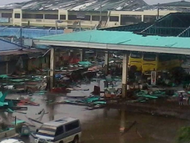
Massive damage in the Philippines
Wind damage on the south shore of Samar Island in Guiuan (population 47,000) must have been catastrophic, perhaps the greatest wind damage any place on Earth has endured from a tropical cyclone in the past century. A massive storm surge must have also caused great destruction along a 20-mile swath to the north of where the eye hit, where Project NOAH was predicting a 17’ (5.3 meter) storm tide.
Wind and storm surge damage were heavy in Tacloban, population 221,000, the capital of the province of Leyte, according to preliminary media reports. Much of Tacloban is at elevations less than ten feet, and several videos posted on YouTube showed a storm surge of at least ten feet moving through the city. The northern (strong) part of Haiyan’s eyewall made a direct hit on the city. Storm Chaser Jim Edds was in Tacloban, and reported that at least ten crewed boats were in the harbor, attempting to ride out the storm. Haiyan’s winds, rains, and storm surge have caused widespread devastation throughout the Central Philippines, though we do not yet have reports from the worst-hit portions of the disaster zone, including the south shore of Samar Island.
Fortunately, the storm’s fast forward speed of 25 mph cut down the amount of rain the storm dumped, compared to typical typhoons that affect the Philippines. Hopefully, this will keep the death toll due to flash flooding relatively low. Flash floods are usually the biggest killer in Philippine typhoons.
Bron. Wundereground.com